
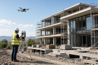

Accurate site information and clear documentation are two of the biggest challenges in construction. Traditional methods—tape measures, scattered photos, and occasional site visits—are slow, incomplete, and frequently lead to errors, disputes, and change orders. Reality capture tools change that by creating precise digital records of a site quickly and consistently.
These technologies (primarily 3D laser scanners, drones, and photogrammetry) give project teams reliable data they can use from early design through final as-built records. Here’s how they improve project management and documentation in practice.
Faster and More Accurate Site Surveys
3D laser scanning captures millions of measurement points in minutes, producing a detailed point cloud of existing conditions. This is especially valuable on renovations, additions, or sites where drawings are outdated or missing. Teams spend far less time on manual measurements and reduce the risk of costly dimension mistakes later.
Drones complement laser scanning by covering large areas or hard-to-reach zones quickly. They generate aerial imagery, topographic data, and progress photos without requiring someone to walk the entire site. Together, these tools shorten the survey phase and give designers and estimators better starting information.
Higher-Quality Documentation with Fewer Disputes
Handwritten notes and inconsistent photos often create incomplete records and disagreements over what was actually built. Reality capture produces an objective digital record—point clouds, 3D models, and high-resolution imagery—that everyone can reference. Owners, architects, contractors, and inspectors work from the same data, which reduces arguments and speeds up decisions.
When the data is organized in a document management system or BIM platform, it becomes even more useful. The records are searchable, shareable, and available long after the project ends for facility management, future renovations, or warranty work.
Better Integration with Design and BIM
Reality capture data feeds directly into Building Information Modeling workflows. Existing conditions can be modeled more accurately, design options can be tested against real site constraints, and conflicts can be identified earlier. Catching issues in the digital model is almost always cheaper and faster than discovering them in the field.
This integration helps keep projects closer to the original schedule and budget by reducing late surprises.
Clearer Progress Monitoring
Project managers no longer have to rely only on scheduled site visits. Regular drone flights provide aerial views of the entire site, while laser scans or 360° imaging can document specific areas in detail. Comparing successive captures makes it easier to track progress against the schedule, spot potential delays early, and communicate status clearly to clients and stakeholders with visual evidence rather than just reports.
Improved Safety and Risk Management
Many site conditions are difficult or dangerous to measure manually—elevated areas, unstable ground, or active work zones. Reality capture reduces the need for people to enter those areas for routine documentation. The detailed data can also support safety planning and training by showing actual site conditions instead of relying on generalized drawings.
Reduced Rework and Change Orders
Most change orders stem from incomplete information or late discovery of conflicts. When teams have accurate existing-condition data and frequent visual records, problems surface earlier—often during design or coordination rather than during construction. Identifying and resolving issues sooner protects both the schedule and the budget.
Practical Considerations Before You Adopt Reality Capture
Not every project needs full 3D laser scanning. Smaller residential remodels may benefit from simple drone photos and 360° walkthroughs, while complex commercial, historic, or tightly constrained sites often justify higher-accuracy scanning. Before committing, evaluate:
- Project size, complexity, and accuracy requirements
- How the data will actually be used (design, documentation, progress tracking, as-builts)
- Team ability to process and manage the files
- Overall cost versus potential savings from reduced rework and faster surveys
Industry organizations such as the National Institute of Building Sciences (NIBS) and groups focused on BIM and digital construction provide useful guidance on applying these tools effectively.
Bottom Line
Reality capture tools give construction teams better information, faster. Used well, they improve survey speed, documentation quality, stakeholder communication, and the ability to catch problems early. The result is fewer surprises, less rework, and a clearer, more reliable record of the project from start to finish.
Related Articles You May Enjoy From FINE Magazine
- 5 Tips to Construct a Commercial Building
- 10 Pieces of New Construction Technology to Watch
- Factors that Could Increase Commercial Construction Cost

(0) comments
We welcome your comments
Log In
Post a comment as Guest
Keep it Clean. Please avoid obscene, vulgar, lewd, racist or sexually-oriented language.
PLEASE TURN OFF YOUR CAPS LOCK.
Don't Threaten. Threats of harming another person will not be tolerated.
Be Truthful. Don't knowingly lie about anyone or anything.
Be Nice. No racism, sexism or any sort of -ism that is degrading to another person.
Be Proactive. Use the 'Report' link on each comment to let us know of abusive posts.
Share with Us. We'd love to hear eyewitness accounts, the history behind an article.